Hyoscyamus
- Overview
- Images
- Identify
- Taxonomy
- Occurrence
- Specimen
MX.finnish
Yes
Occurrence in Finland
MX.occurrenceInFinlandCollected
Observations in Finland
The map represents observations of this taxon, but it may not be used as a distribution map.

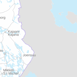


Click before zooming
squares
Observations
- Total squares
GBIF
The map represents observations of this taxon, but it may not be used as a distribution map.
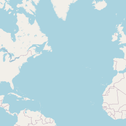

Click before zooming
Distribution by biogeographical provinces according to expert evaluation
- MX.typeOfOccurrenceOccursBasedOnOccurrences
Observations per month in Finland
Observations per year in Finland
The chart shows temporal distribution of the observations, which is not the same as population increase/decrease.
Habitat
The following biotope data have been recorded for observations of this taxa
Record type
687
642
MY.lifeStage
11
8
7
1
1
MY.sex
8
Datasets and collections